![]()
Discovering Taupo
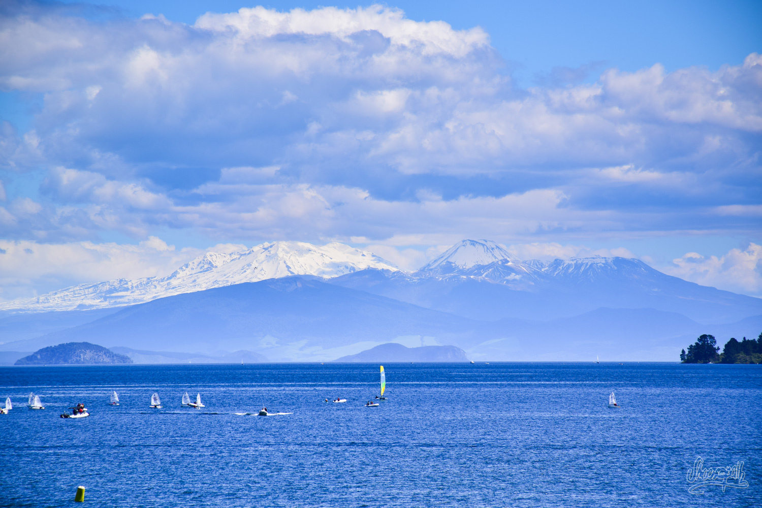
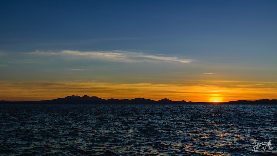
From Rotorua and its geothermal resources, we arrive in Taupo, a lovely city situated on the shore of a great lake, that looks like mediterranean sea and the north italian lakes. In the distance, the magnificent Tongariro National Park, a World Heritage Site, stands by the full height of three snow-capped volcanoes above this daydream region. Sublime scenery!
We fall in love with it. The city offers a lot of water sports and open air activities, many hiking trails, and is situated right in the center of North Island, making it a perfect base to visit the area. Especially since we have found a great free campsite along the Waikato river, the longest river in New Zealand.
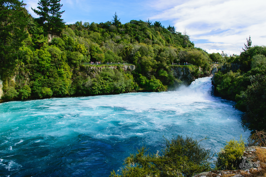
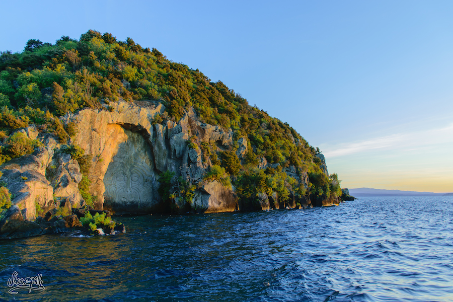
Not far from here are the Huka Falls. Beautiful waterfalls, not very high but the powerful waters make them impressive. There are also hot pools at 40°C along the river, and some huge maori rocks carvings on a cliff that you can visit by boat.
At the campsite, we meet two very nice French guys (really, they are everywhere!!). Pierre and Antonin are from Lyon and we decide to go hiking together on the the volcanoes of the Tongariro National Park the following day. Indeed, the walk is not a loop, so it’s better to go there with two vehicles, to avoid the exorbitant shuttle fees.
Up to Mt Tongariro summit
Difficult to put on paper words that describe with sufficient acuity the splendor and vastness of the Tongariro National Park. We have tried in many forms and phrases to recreate the beauty of this spectacular place, but each try seems to remain a pale description of what is surely one of the most beautiful hikes that we‘ve been given to walk.
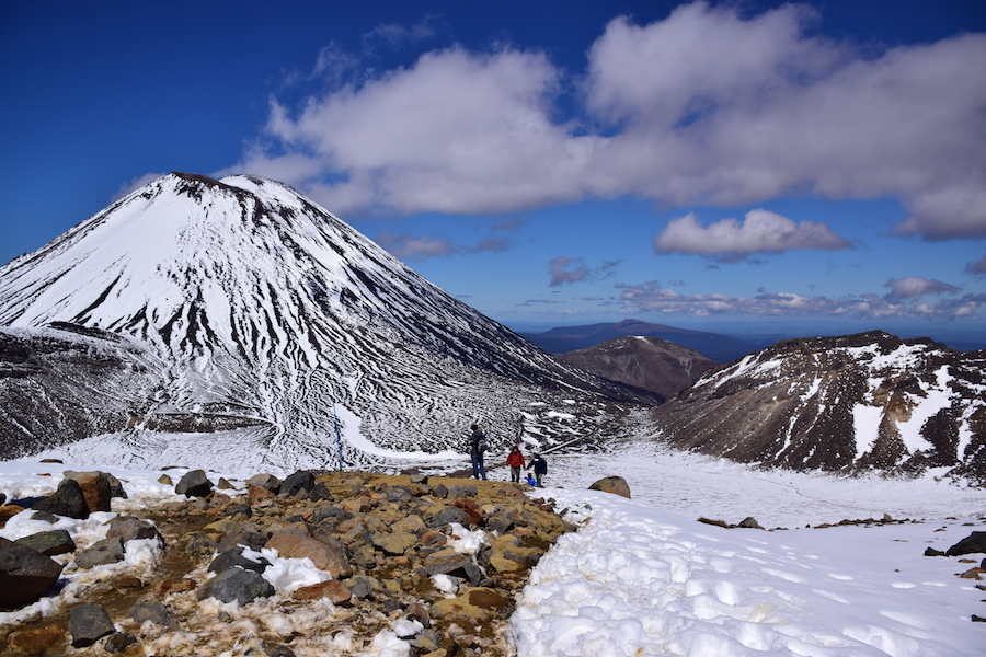
At 8am, we are at 1100m high at the begining of the 19,4km track, known as the most beautiful hike in a day in the country. We are very surprised by the number of people already walking up the track. To be fair, it is a real highway! But the incredible landscape made us forget quickly about this detail. The sky is clear. The colossals Mt Ruapehu (2797m), Mt Tongariro (1967m) and Mt Ngauruhoe (2287m), still covered with a white blanket of snow, are shining in the morning sun. With delight, we breath deeply the pure morning air while starting the climb up, going along a melodious stream punctuated occasionally by a short waterfall. We have not taken three steps that the panorama already overwhelms us.
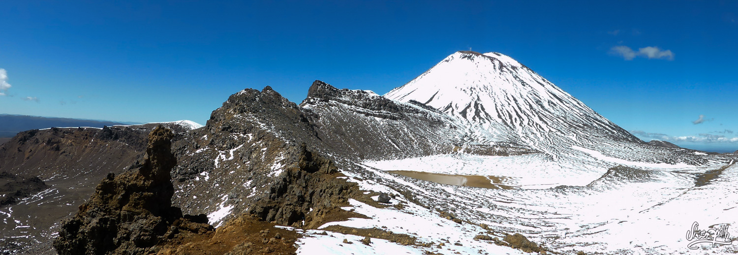
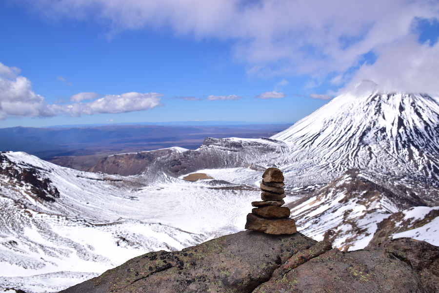
The black and rusty volcanic plain is dotted with ocher tufts of grass which soon mingle with the first snowfields. The track rises abruptly to a first snowy plateau, old crater that we have to cross. We are in Mordor at the feet of Mount Doom (Mt Ngauruhoe) and we’re out of breath. Indeed, Peter Jackson chose the incredible panoramas of the Tongariro National Park to shoot scenes of the Kingdom of Sauron for The Lord of the Rings movies. We would have loved to climb this famous mountain, but the unmarked trail is too snowy and it is definitely not a good idea to attempt the climb without crampons and ice axes. It will be for the next time… And while some hikers still choose to do it and reach the top, we continue the climb to another summit, adding 6km to the trail.
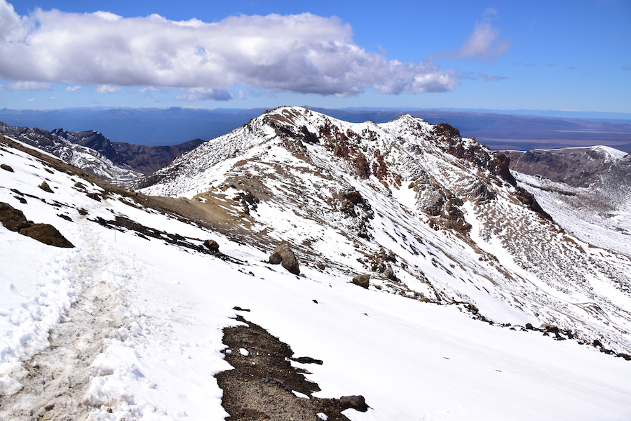
We climb up another 900m, cross scree and snowfields, then finally reach the summit of Mt Tongariro. Feet in the snow, we enjoy the dazzling scenery. Mt Ngauruhoe, shining like a diamond, is in the base of the volcanic valley, a dizzying distance away. Strange basaltic concretions give the landscape a dreamlike atmosphere.
Going down by the lakes
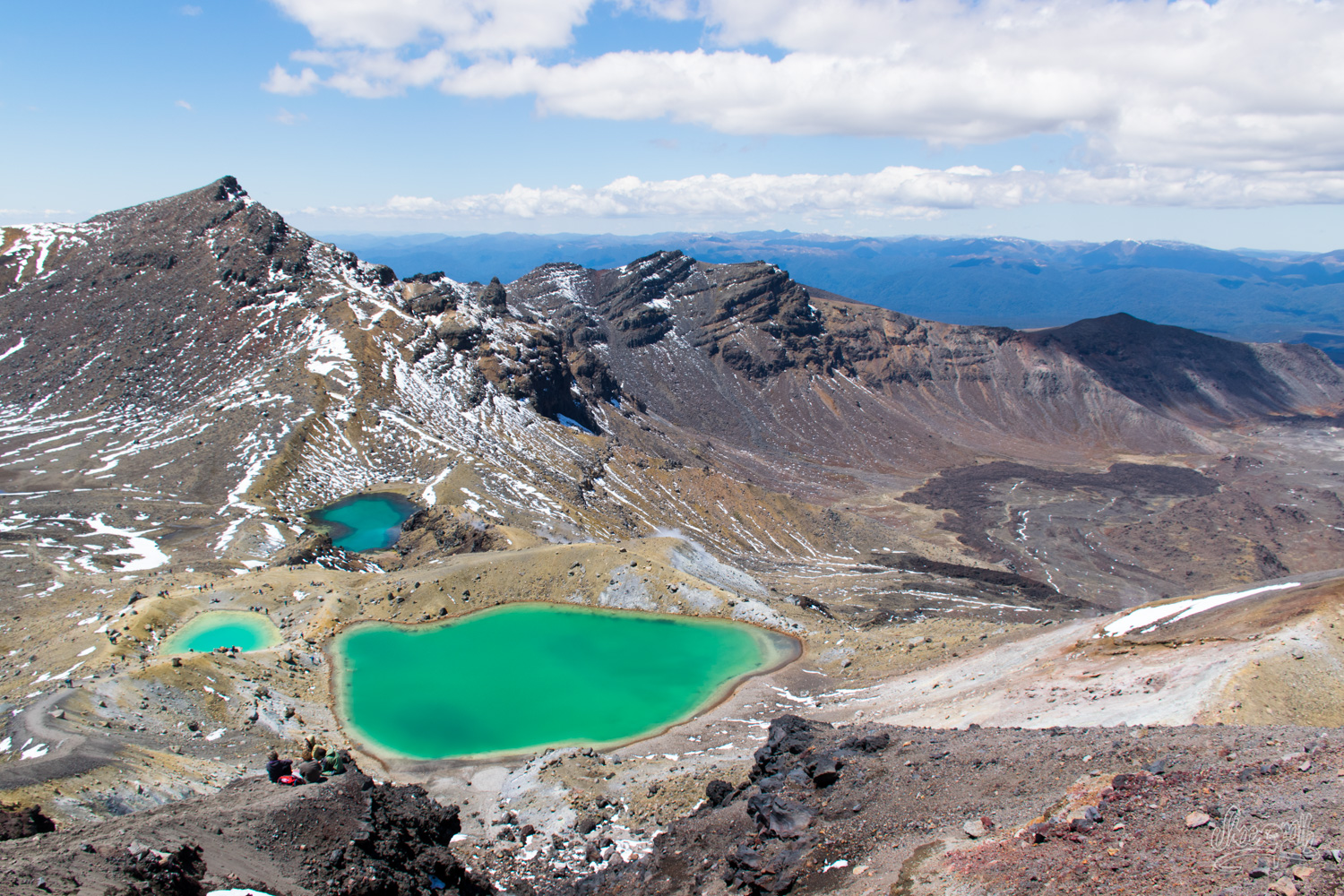
We walk down the peak via a new unbalanced scree, enjoying a double breathtaking view on the valley we just have gone through, as well as on a second volcanic plateau. The icy wind invigorates us. Antonin leads the walk and we try our best to follow him. Suddenly the view opens on an incredible crater lake, true azure waters set deeply in a gloomy black panorama. Three smaller lakes with spectacular colors then make their appearance. Surreal moment. Simply breathtaking! Down the scree, we don’t loose one minute to explore the lakes! Crazy Antonin jumps in the smaller lake, which temperature certainly not exceeds 10°C, arguing that this will probably be the only ocacsion in his life to do such a thing!
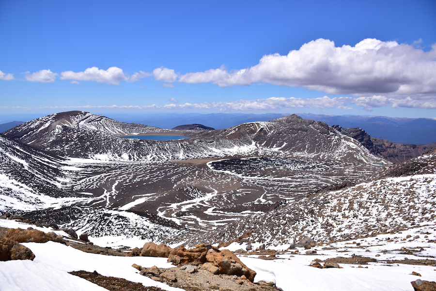
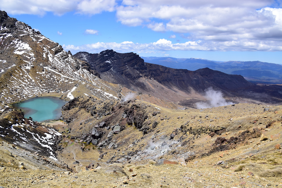
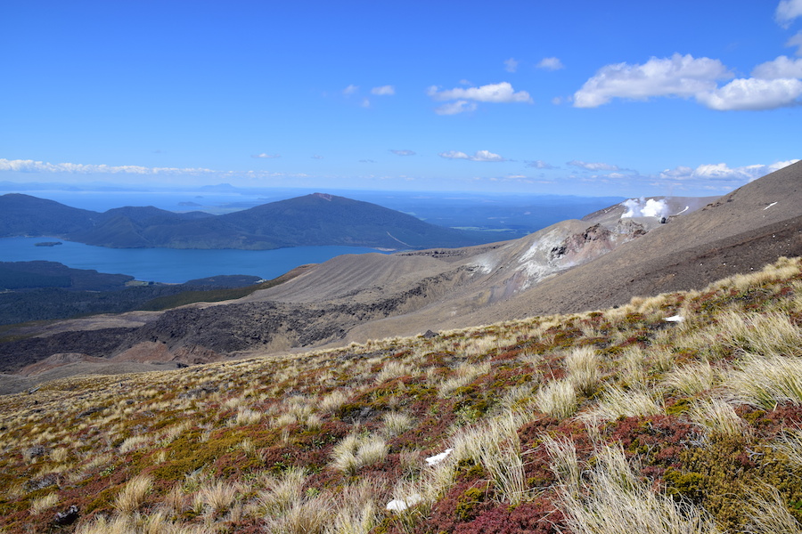
We walk through the crater, go around the big blue lake, then fall on the other side and begin our descent into the valley. A lake below mirror the intensely blue sky. The trail winds through the tall red grass. Fumaroles escaping of the sides of the giant reminds us that the volcanic activity is still omnipresent. Pierre is a chef, so we spend our time going down speaking of all our favorite recipes and culinary desires. From the squeegee or turkey cutlets with blue sauce, quiches, lasagna, or all kinds of fishies. Real torture.
Soon we enter into a lush forest that announces the end of the 25km walk. We’ve made it in 7 hours. Our knees play castanets. Our bodies remind us that we have not hiked for too long, but we are intensely happy! Our souls are filled with a relishing feeling of fullness and our memories are overflowed with images of this land of Gods!!
See you soon !
Tintin & Riette
Tongariro Alpine Crossing :
- 19,4km long trek, 6 to 8 hours without stops. Add another 6km for around 1:30 hours to clinmb the Mt Tongariro summit.
Access by several kilometers of gravel road.
Be aware of the forecast and weather conditions before driving to the place. The temperature can be very low in altitude, strong winds, rain or snow may occurs at any time.
Equip yourself with good shoes, high shoes if it’s still snowy. Take a lot of water and sufficient food to have enought energy. - Climbing Mt Ngauruhoe : around 3h. Non marked track. Be aware of the weather and conditions up there. The climbing may need some crampons and ice axe.
- Shuttle between the two ends of the tracks must be booked in advance : 30$/person
- A free DOC campsite is situated in proximity of the highway 1 south of Turang. Access by gravel road.
Vous aimerez peut-être aussi :
Comments (0)